
Walk with photographer Keith Dotson into the woods as he searches for the nearly forgotten town of Jefferson, Tennessee
The historic town of Jefferson, Tennessee was thought by many to have been lost under the
waters of Percy Priest Lake, which was filled after completion of a dam in 1967. Only within recent years was the original townsite rediscovered by a member of the Native American History Association while they were exploring Google maps, looking for a forgotten Trail of Tears route.
History of Jefferson Tennessee
The town of Jefferson Tennessee was founded in 1803 and by 1804 it was selected as the first county seat of Rutherford County, which itself was also a newly formed county. The people founding the town selected that property at the fork on the Stones River because it was a great place to locate wharves for river travelers and shipping. They envisioned a place with a busy seat of government combined with a bustling river-based economy.
By 1810, 107 people lived in Jefferson and a variety of businesses were being established around the vicinity of the seat of government and the public square. There was a new brick courthouse, a log jail, wharves along the river and warehouses to store goods, a mill, and at least one ordinary — which was a tavern or inn which provided alcohol, food, and rooms for guests — usually established in a home.
By 1811, the population in the county had grown and migrated south. Jefferson became an inconvenient location and it was decided that the county seat should be moved to a more central part of the county, which happened to be the city of Murfreesborough.
That reduced the prospects of Jefferson, which had profited from the traffic in town for court sessions. Also, depending on seasons and rainfall amounts, the river levels were sometimes too low for boats to navigate and that also impacted the commerce of the town.
People continued to live in Jefferson of course, and to establish businesses there. There were also big family farms there, but it became a relative backwater compared to faster growing parts of the county like Murfreesborough, the new county seat.
Why did the government take the town?
Jefferson was nearly surrounded by the Stones River. Flooding was a problem in the region, and Nashville needed the water, so in 1938, Congress approved a project for the building of a dam, which would create Stewarts Ferry Reservoir, now called Percy Priest Lake.
The dam was approved for construction in 1958 and construction began in 1963. The dam was completed in 1967. Federal studies showed the town would be deluged when the lake was full so the town was acquired by the Federal government, and the entire town was bulldozed to the ground.
One source said it was actually burned to the ground but most sources say the Army Corps of Engineers had it bulldozed to the ground.
Some homes and historic structures were actually moved away from Jefferson before the razing of the town. Old photos show at least one old house being moved, and this history said a man named Lee Victory, who owned the Lenoir House, had it dismantled and moved to Smyrna, Tennessee.
However, it appears that the Corps of Engineers didn’t account for a large number of nearby caves, which drew in more water than expected. That left the town site high and dry. The water levels along the shores of the Stones River at Jefferson are only slightly higher than they were before the construction of the dam.
So yeah, the town was leveled for nothing. Keep in mind that this affected people who had in some cases been farming the land for generations. I read one quote from a man whose family farm was taken, who said he still held resentment against the Army Corps of Engineers for taking that farm away.
But the funny part is it seems no one realized Jefferson didn’t go under the water. It seems that everyone assumed Jefferson was under the lake and over time it was just forgotten. There were stories online about the town under the lake.
From what I can tell, it’s only been since the late 2000s that people started looking at maps and realizing that the townsite was still above the water level.
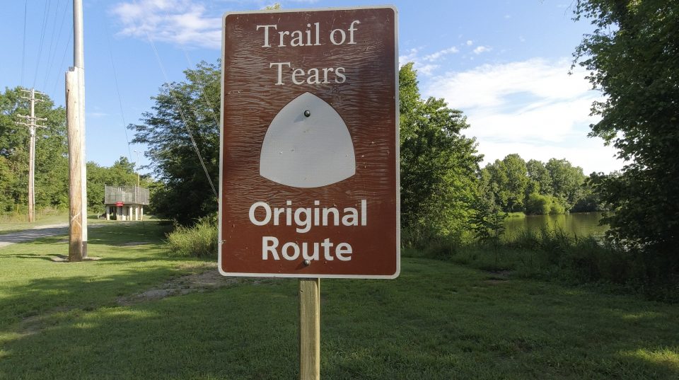
Jefferson was on the original Trail of Tears route, and it was announced in 2012 that a forgotten stretch of the Trail of Tears at Jefferson had been discovered. The Army Corps of Engineers and the Native History association made subsequent announcements in 2014 and 2015 that the rediscovered trail was open to the public.
Visiting Old Jefferson
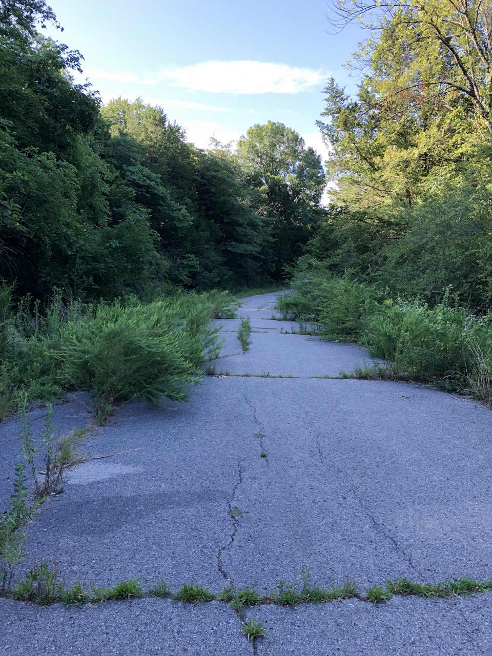
When the Trail of Tears original route markers were placed, the old roads into Jefferson were opened to the public. Today the main use appears to be as a horse trail, but when I went during summer, the roads were overgrown and appeared lightly or rarely used.
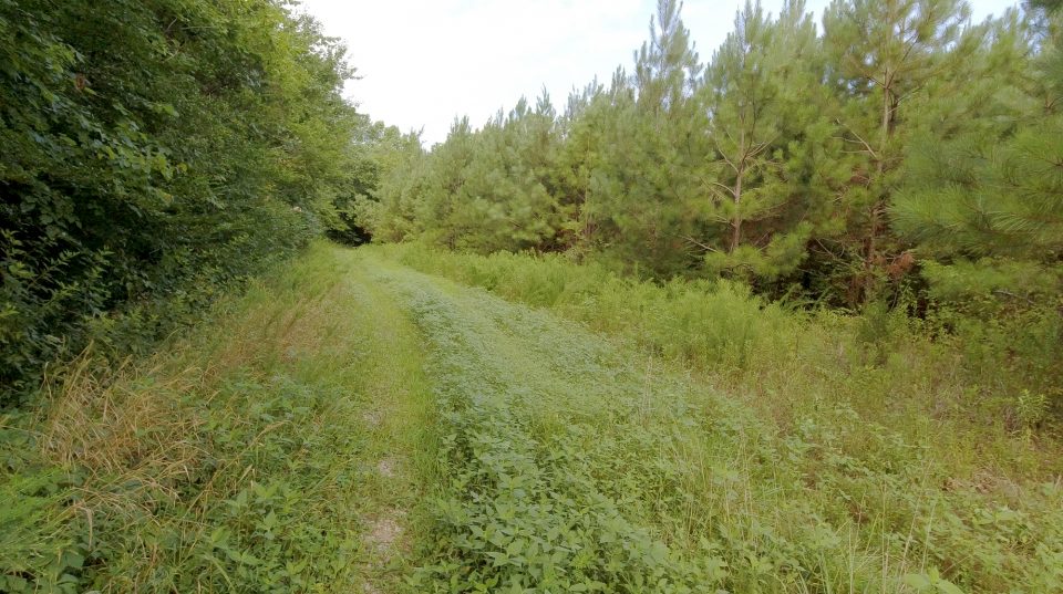
As shown in the video, the most convenient parking is at the East Fork Boat Ramp parking lot. Follow either the paved road or the hiking trail in the direction of the water pumping station to locate the road that leads to Jefferson.
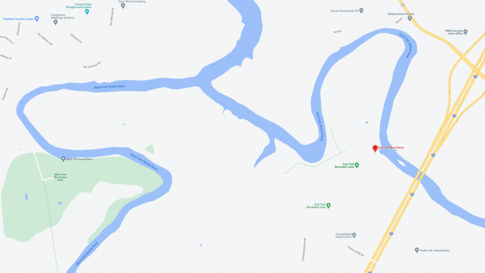
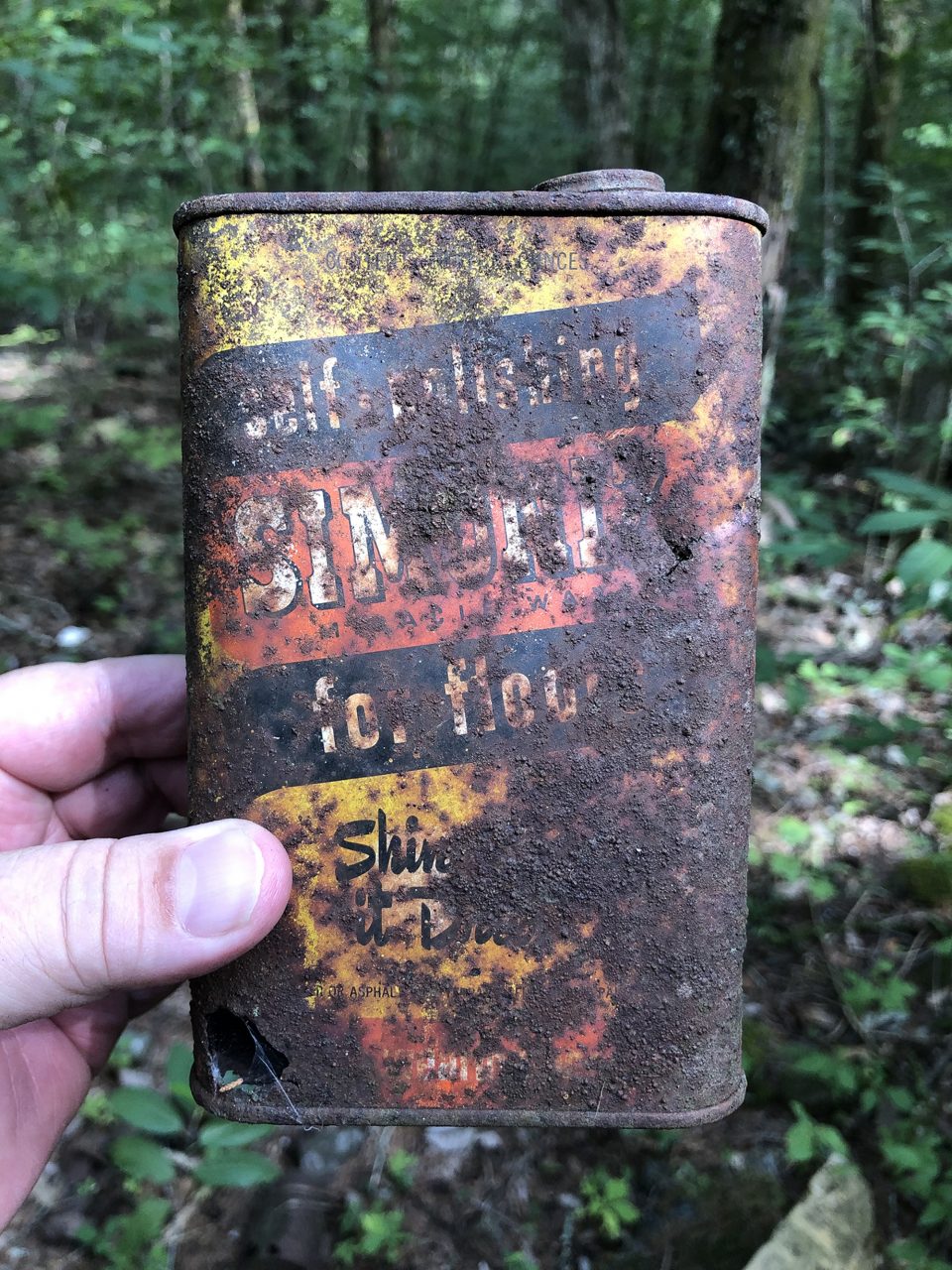
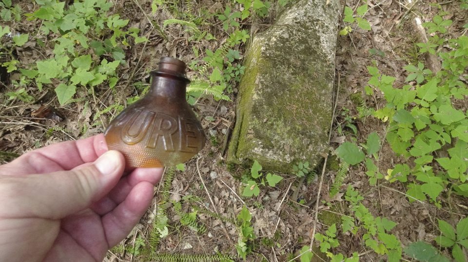
I walked into the woods hoping to find evidence of the town but realized it would be difficult to see ruins amidst all the summer greenery. Fortunately, I did locate a mound that looked promising, so I stepped into the woods to investigate, and what I discovered was a demolished building and perhaps a dumpsite filled with old rusty cans and bottles of every shape and size.
It was fun poking around to see what history could be found among the briars, weeds, and poison ivy.
Please note: The town of Jefferson land is under the jurisdiction of the Army Corps of Engineers, so it is federal property. It’s open for visitation, but don’t remove artifacts. They are protected.
Thanks for reading.
Be sure to visit me on Instagram, YouTube, or Pinterest, or on my website at keithdotson.com.
~ Keith
Sources and Links
dvids.net, U.S. Army Corps of Engineers, Nashville District, “Corps invites public to hike rediscovered segment of Trail of Tears,” Leon Roberts, May 13, 2015
Library of Congress, “Map of Rutherford County, Tenn. : from actual surveys,” D.G. Beers & Co.,
Philadelphia : D.G. Beers & Co., 1878
Native History Association, “The Old Jefferson Site”
Only in Your State, “Step Inside The Creepy, Abandoned Town Of Old Jefferson In Tennessee”
Rutherford County Historical Society, “A History of the Town of Jefferson”
Rutherford County Historical Society, “Jefferson Page”
Tennessee Virtual Archive, Map of Rutherford County Tennessee 1916
Wikipedia, “Percy Priest Lake”
Discover more from Shadows and Light
Subscribe to get the latest posts sent to your email.