
Join fine art photographer Keith Dotson as he returns to Route 66, this time on the Oatman Highway
In this video, we are on the old Route 66 alignment that goes through the mountains to Oatman, Arizona by way of the Sitgreaves Pass.
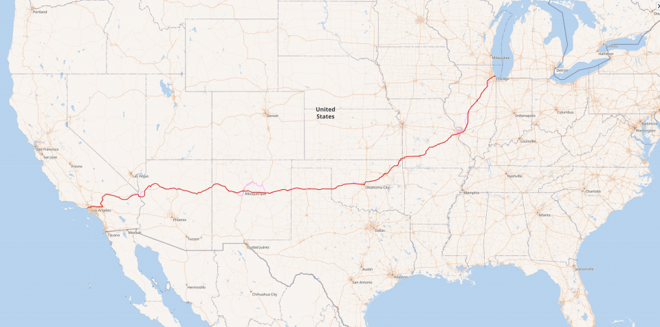
Wikimedia | © OpenStreetMap. Used under license (CC BY-SA 2.0).
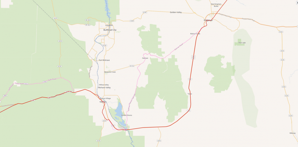
These maps show the old U.S. 66 with various alignments (courtesy of Wikipedia and OpenStreetMap). In the video, we are start out on the Kingman side, heading West through Oatman and onward toward Needles, California.
According to the Arizona Department of Transportation, the Kingman to Oatman stretch of U.S. 66 was an older alignment closed in the early 1950s because it needed a lot of repairs, and it was really twisty and hazardous. You may not know this but Route 66 changed over the years, with various realignments along the way.
If you’ve ever listened to the popular song, written in the 1940s by Bobby Troup and performed first — and best in my opinion — by Nat King Cole in 1946, you’ll remember that Nat King Cole listed some of the cities that the highway passed through.
The list included Flagstaff, Winona, Kingman, Barstow, and San Bernadino — no mention of tiny Oatman. Probably too hard to find a rhyme.
And, did you ever notice that Nat King Cole pronounced it Barstoh with a long “o” whereas Chuck Berry and the Rolling Stones (doubtless emulating Chuck Berry) both pronounced it Barstough – rhyming with cow?
A Brief History of Route 66
Route 66 was officially launched in 1926, and it was originally pieced together by a series of county, state, and national highways. The road boomed in the 1930s when the Great Depression and the Dust Bowl launched a migration of poor and displaced people westward in search of a new start.
It got its nickname “The Mother Road” from John Steinbeck in his 1939 novel The Grapes of Wrath.
During the 1940s and World War II, mom-and-pop businesses that had sprung up along the Route made-up for decreased civilian travel by selling to members of the military, which used Route 66 as a transportation corridor.
In the 1950s, as middle class wealth, leisure time, and car culture increased, Americans used Route 66 to travel west, visiting such sites as The Grand Canyon, The Painted Desert, and of course Los Angeles.
In the late ’50s, President Dwight D. Eisenhouer wanted to remake the American highway system in the model of Germany’s Autobahn, with more speed and no slowdowns in small towns. He sold the expensive project to the Congress and the public based on its military value, and used the Cold War as a reason.
When the Oatman highway was decommissioned in 1953, the price of gasoline was 28 cents a gallon. The average fuel efficiency in the U.S. for all types of vehicles was between 12 and 13 miles per gallon.
The last stretch of Route 66 at Williams, Arizona was replaced by I-40 in 1984 and the highway was officially decommissioned in 1985.
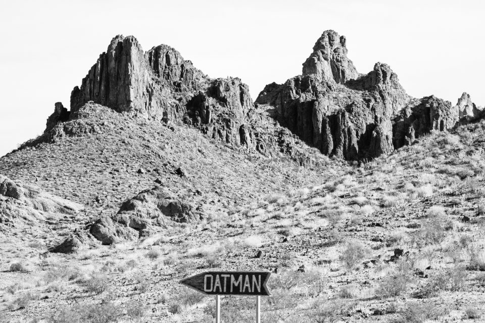
The Oatman Highway
While the Oatman Highway used to be designated as U.S. Highway 66, it’s a now county road. Along its way is the famous Cool Springs service station, built in the 1920s. It’s now a tourist shop. It was abandoned in 1964, 11 years after the Oatman Route 66 realignment. The old gas station was blown to bits for the filming of an action movie in the 1990s, and rebuilt stone-by-stone by a new owner in 2004, that work based on vintage photographs.
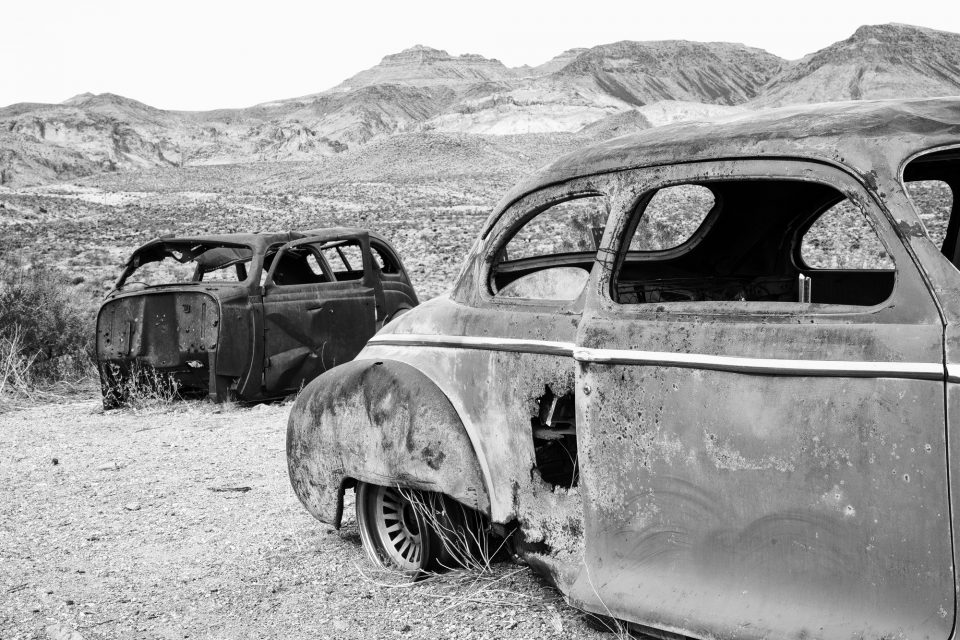
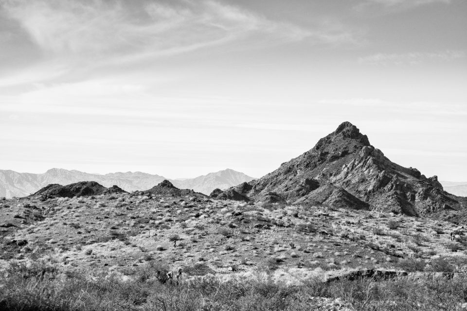
Traveling West by Southwest from Kingman, you enter the Black Mountains, where I made some of my favorite photographs of my entire western road trip. But the trip can be hair-raising. Many of the sharp curves crest steep ledges and some have little or no guardrails, even today.
I’ve read that back in the early days of the road, people were so terrified of driving this part of Route 66, they’d hire a local driver to take them across, or even have their car towed to the other side of the mountains.
The Oatman Highway peaks at Sitgreaves Pass, elevation 3586 feet. From the viewpoint you can see Arizona, California, and Nevada.
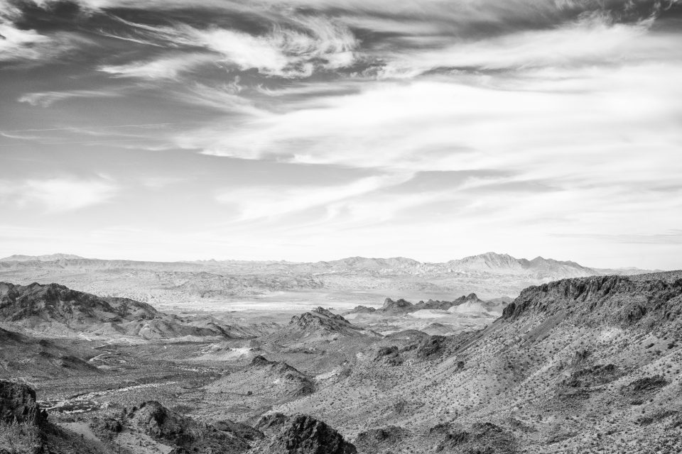
This may be one of my favorite photographs from my entire California road trip. I think it really captures the vastness of this expansive view. There’s so much detail.
Far in the distance, behind that peak you can see a hotel or casino or something way out in that valley.
At Sitgreaves Pass there’s a roadside memorial with markers and signs and remembrances. I’ve read that people often spread the ashes of their departed loved ones there.
Wild Burros
Throughout the hills, in the valleys, and even down on the streets of Oatman, you will see feral burros wandering around. They’re the descendants of burros set free by miners when the gold mines near here were closed.
Links and Sources
Arizona Department of Transportation. “Throwback Thursday: The way US 66 was.”
Map data © OpenStreetMap contributors (Link)
National Park Service. Travel Route 66: Essay Series. “5. Demise and Resurgence of Interest in Route 66.”
RoadsideAmerica.com. “1920s Route 66 Gas Station.”
Wikipedia. “US Route 66.”
Note: This blog post contains an Amazon Affiliate link. I may earn a small commission on qualifying purchases.
Discover more from Shadows and Light
Subscribe to get the latest posts sent to your email.